Łapy-Podlaskie 作者: 来源: 发布时间:2021-10-27
Ⅰ. Population and Area
Population (2010)
• Total 16,049
• Density 1,300/km2 (3,400/sq mi)
Area
• Total 12.14 km2 (4.69 sq mi)
Website www.lapy.podlasie.pl

Ⅱ.Natural Geography (environment and resources)
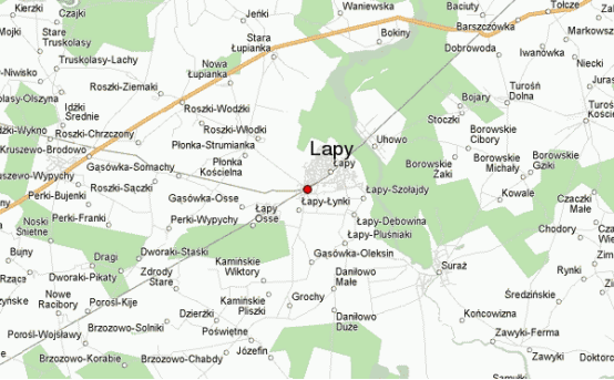
-The city of Łapy is located in Podlaskie Voivodeship, 20 km west of Białystok, about 70 km from the border with Belarus and less than 150 km from Warsaw. The commune is located at the fork of two main national roads: S8 Warszawa - Białystok and S19 Białystok - Lublin. The main railway line Rail Baltica runs directly through the city - the E75 route, which is the European priority corridor connecting Warsaw with Kaunas, Riga, Tallinn and Helsinki.
-The town of Łapy is located in north-eastern Poland. According to Kondracki's division of Poland into physico-geographical regions, the town of Łapy sits on North-Podlasie Plain, over the Upper Valley of Narew. The town of Łapy lies by the Narew River. The terrain is elevated here from 120 to 130 metres.
-Included in Białystok agglomeration, the town is situated in the buffer zone of Narew National Park.
-According to data from 1 January 2010, the town area then was 12.14 km2.
-Between 1954 and 1975 Łapy was the administrative centre of Łapy County of Białystok Voivodeship. Between 1975 and 1998 the voivodeship was smaller.
-Residential areas
-Presently Łapy comprises the following parts:
-Barwiki
-Bociany
-Goździki
-Leśniki
-Osse
-Wity
-Wygwizdowo
-Zięciuki
-Transport
-Roads
-There are two voivodeship roads crossing the town:
- DW 681 Roszki-Wodźki – Łapy – Brańsk – Ciechanowiec
- DW 682 Łapy – Markowszczyzna
-Furthermore, the national road DK 8 runs 19 kilometres (12 miles) to the north, being upgraded to S8 express-way.
-Railway
-There are two railway routes going through the town:
-Saint Petersburg–Warsaw Railway (Białystok – Warszawa)
-Łapy – Ostrołęka (partly out of order)
-Łapy hosts a railway station for all kinds of trains, which is situated in the town centre; and a railway stop Łapy Osse for slow trains only, in the Osse quarter, 3 km (2 miles) from the centre.
-Łapy's railway destinations are numerous: Bielsko-Biała, Warszawa, Suwałki, Białystok, Wrocław, Opole, Częstochowa, Kraków, Szczecin, Poznań.
-Bus services
-There are many small PKS bus stops and the main one – Łapy, next to the railway station building in the centre, from which local lines operate in the directions of Białystok, Zambrów, Siemiatycze, Bielsk Podlaski, etc.
-Bike and foot trails
-Szlak rowerowy czerwony.svg Red bike trail; the ring route of Narew National Park
-Choroszcz – Zawady – Baciuty – Dobrowoda – Turośń Dolna – Borowskie Michały – Suraż – Łapy – Płonka Kościelna – Stara Łupianka – Jeńki – Waniewo – Kurowo – Stare Jeżewo – Tykocin – Choroszcz
-POL Szlak czerwony.svg Red foot trail of Włodzimierz Puchalski – 36 km
-Łapy Osse – Gąsówka-Osse – Płonka Kościelna – Płonka-Strumianka – Stara Łupianka – Bokiny – Jeńki – Waniewo – Kurowo – Stare Jeżewo
-POL Szlak zielony.svg Railwaymen's green foot trail
-Łapy Osse – Grochy – Turek – Pietkowo – Suraż
Ⅲ.Economy
-An entrepreneur running a business in the Łapy Subzone of the TSEZ EURO-PARK WISŁOSAN may apply for public aid in the form of tax exemptions up to 50% of investment expenditure or 50% of two-year labor costs of new employees in the case of large enterprises, 60% for medium-sized enterprises and as much as 70% for small entrepreneurs.
-Convenient location, attractive transport connections, proximity to eastern markets, but also attractive in terms of price (approx. PLN 35 / m²) and investment areas ready for business as well as wide availability of qualified employees, both in Łapy and nearby Białystok, make it a a place with great investment potential.
-The Łapy commune offers about 24 hectares of land for investment. Half of the plots are fully developed and now belong to the Łapy Subzone of the Tarnobrzeg Special Economic Zone. More plots are being prepared to be included in the Subzone. These will be areas equipped with the necessary infrastructure: sanitary and rain sewage system, teletechnical sewage system and an internal road with lighting.
-http://www.lapy.pl/index.php/miasto-i-gmina/polozenie-i-charakterystyka
Ⅳ.Industrial Characteristics
-Until 2009, Łapy's economy was mainly based on the then functioning: sugar refinery, being one of the best in Poland and selling its sugar to inter alia Islamic countries and to the Middle east; and Railway Fleet Repair Works.
-Unfortunately for the town, both of the works have been closed.
-There are plans to create a subzone of Tarnobrzeg Special Economic Zone. A corresponding bill has been submitted at The Cabinet.
-The development of industrial economy in Łapy and its neighbourhood is hindered first of all by the close proximity of Narew National Park. On the other hand, the town has a potential for the tourism industry.
-Łapy - Wikipedia https://en.wikipedia.org/wiki/%C5%81apy#Economy
-Key projects
-1. Road Gąsówka-Skwarki - Gąsówka-Osse is ready!
-Another poviat road has undergone a major renovation. Almost 1.5 km long, bituminous surface was laid and gravel shoulders were made.
-The ceremony was attended by: mayor Krzysztof Gołaszewski, voivode of Podlasie Bohdan Paszkowski, starost of the Białystok Poviat Jan Bolesław Perkowski, deputy staroste Roman Czepe together with councilors of the Białystok Poviat Council: chairman Zenon Żukowski, deputy chairman Mariusz Gołaszewski, Andrzej Busłowski, and secretary Mariusz Gołaszewski, Andrzej Busłowski Joanna Kondzior. The councilors of the City Council in Łapy were also present: Karol Brzozowski, Maciej Michno, Andrzej Rogowski, Wiesław Szustak and Dariusz Wincenciak. Among the guests was also the mayor of the Poświętne commune, Witold Łapiński. There was also the director of the County Road Administration in Białystok, Marek Jędrzejewski, the mayor of the village of Gąsówka-Osse, Kazimierz Brzozowski, and the mayor of the village of Gąsówka-Skwarki, Marian Łapiński. Residents also came to the ceremony.
-Łapy - Gąsówka-Skwarki road - Gąsówka-Osse is ready! http://www.lapy.pl/index.php/aktualnosci/1790-droga-gasowka-skwarki-gasowka-osse-gotowa
-2. Electric car charging points will be built in the Łapy commune
-Next to the summer swimming pools in Płonka Kościelna and at the Entrepreneurship Incubator in Łapy - it is in these two locations that you will soon be able to charge your car. We discussed the details with the mayor of Łapy, Krzysztof Gołaszewski.
-Łapy - News http://www.lapy.pl/index.php/aktualnosci?start=30
Ⅴ.Attrations and Cityscape
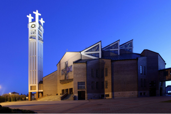
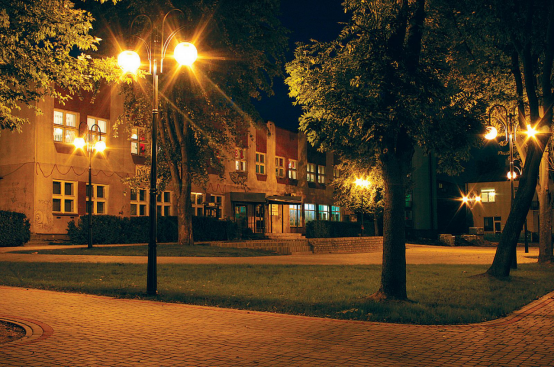
-This is the name of the picturesque Narew backwaters in the vicinity of Łapy. The city is located in the buffer zone of the Narew National Park. The river, full of meanders, creates a unique refuge here, which is a remnant of the primeval nature. Lovers of active leisure have the opportunity to experience wildlife directly and learn about its beauty from kayaks, bicycles and on foot. The proximity of the Białowieża Forest, the Knyszyńska Forest and the Biebrza National Park - they are located several dozen kilometers from Łapy - makes this place appreciated by active people.
-Historical buildings
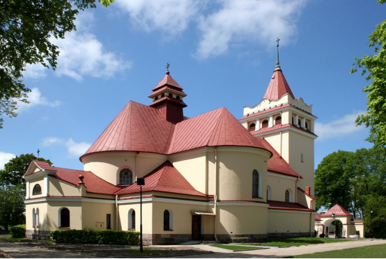
-St. Archangel Michael's parish church complex in Płonka Kościelna:
-1800 wooden chapel
-c. 1905 brick church
-c. 1905 fence and brick gate
-The water tower in the complex of the railway station, built at the beginning of the 20th century
-1920s Etkun's House in Spółdzielcza Street
-St. Peter and Paul's parish church complex:
-1920-27 brick gate
-c. 1929 wooden presbytery
-c. 1930 brick vicarage
-1920 chapel
-St. Adalbert's parish church complex in Uhowo
-Four wooden houses built in 1924 in the railwaymen's settlement Wygwizdowo
-27 brick houses built in the 1930s in the railwaymen's settlement Osse
-Block group in Sikorskiego St. and Spółdzielcza St.
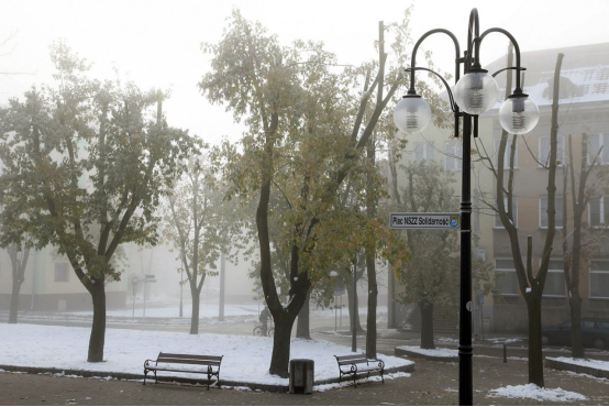
-Market square
-Memorials
-The statue of Jan III Sobieski in the nearby village Płonka Kościelna
-A stone dedicated to LTC Stanisławo Nilski-Łapiński
-The statue of Heroic Polish Children, dedicated to the children killed during the World War II
-Graveyards
-Historical church graveyard in Płonka Kościelna
-Roman Catholic graveyard in Płonka Kościelna
-Orthodox graveyard in Osse
-Roman Catholic graveyard in Uhowo
-Jewish cemetery in Łapy
-Nature
-Narew National Park
-Bike and foot trails
Ⅵ.History and Culture
-Foundation
-The name 'Łapy' is of Masovian origin, and it initially represented a soubriquet of the kin, who founded the settlement on Narew. A legend links the foundation of the town with the nobleman Łappa of the Lubicz coat of arms, who settled down here during the 15th-century Masovian colonisation.
-The first historical records of these lands come from the early 13th century. It is known that in 1375 Płonka Kościelna was an independent parish. Firstly Łapy was a backwater where the gentry cultivated patriotic traditions. Soon as a result of the village's development, new settlements emerged on the eastern and the western banks of the river Narew, which was a water trade route from Suraż to Gdańsk in 16th and 17th centuries, and after the WW II from Puszcza Białowieska to Tykocin; and at the east side of the high road from Suraż to Płonka.
-Expansion
-Following the expansion of the family, a series of backwaters were founded, including Rechy, Brusięta, Barwiki, Korczaki, Pluśniaki, Wągle, Wity, Zięciuki, Kosmyki, Łazie, Stryjce, Wojtysze. Some of those names disappeared replaced by others, such as: Goździki, Dębowizna, Bociany, Leśniki. After the Third Partition of Poland, Łapy lied in the Prussian Part, and in 1887, after the Tilsit Peace Treaty, it became a part of the Duchy of Warsaw, and later, in 1815, of The Kingdom of Poland. An important event for the future history of Łapy was Napoleonic army's marching through twice in 1812. In the 1820s the backwaters had 1000 inhabitants and 180 houses. In 1825, a fusion of six backwaters (Łapy-Barwiki, Łapy-Leśniki, Łapy-Zięciuki, Łapy-Wity, Łapy-Goździki, Łapy-Bociany) produced the farm settlement of Łapy.
-Industrialisation
-Łapy owes its development to the Saint Petersburg–Warsaw Railway with a station here, opened on 15 December 1862 and to the French having built here the works for repairing steam locomotives and carriages the same year. That caused an influx of tradesmen and labourers not only from the nearby villages, but also from distant Polish locations and from The Russian Empire.
-In the night of 22/23 January 1863, the railway station was captured by a group of railwaymen from the works and Władysław Cichorski Zameczek's insurgent detachment.
-The repair works exist today as 'ZNTK Łapy S.A.' They played a decisive role in Łapy's urbanization, the town charter granted on 1 January 1925.
-At the eve of World War II, the town population reached 8000 citizens. During the war operations, the town was 80% destroyed, and the entire local Jewish population was murdered.
-Prominent people
-Józef Kosacki, the inventor of the first mine detector was born in Łapy. His device was a significant contribution to the Allies' victory in WW II.
-Waldemar Kikolski a paralympic athlete was born in Łapy. He competed mainly in category T11 distance running events.
Ⅶ.Other Information
-Łapy [ˈwapɨ] is a town in north-eastern Poland, in Białystok County (powiat), Podlaskie Voivodeship; the administrative center of the urban-rural gmina Łapy. It is situated in the North Podlasie Lowland, on the river Narew.
-According to data from 31 December 2010, the town had 16,049 inhabitants.
-Situated here are the bankrupt Railway Fleet Repair Works, a dairy, and the sugar refinery closed in February 2008. Now, Łapy is a medical and educational center for the region of the former Łapy county.
Ⅷ.Contact Information
-Government
-Mayor Krzysztof Gołaszewski
-Town Hall in Łapy ul. Gen. Wł. Sikorskiego 2418-100 Łapy
-NIP: 5420004071
-REGON: 000523330
-Telephone exchange: 85 715 22 51
-Fax: 85 715 22 56
-E-mail: sekretariat@um.lapy.pl
