Lund,Norway 作者: 来源: 发布时间:2021-02-20
一、所属省或是州,具体位置,人口,面积
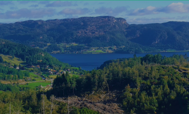
Lund is a municipality in Rogaland county, Norway. It is located in the traditional district of Dalane. The administrative center of the municipality is the village of Moi. Other villages in Lund include Eik and, Heskestad. European route E39 and the Sørlandet Line both pass through Lund. Moi Station is a railway station in Lund.

The 408-square-kilometer (158 sq mi) municipality is the 237th largest by area out of the 356 municipalities in Norway. Lund is the 222nd most populous municipality in Norway with a population of 3,202. The municipality's population density is 9 inhabitants per square kilometer (23 / sq mi) and its population has increased by 2% over the previous 10-year period.
二、自然地理
1.地理条件
The municipality of Lund lies in southeastern Rogaland county, along the border with Agder county. The municipality of Sokndal lies to the south, Eigersund lies to the west, Sirdal (in Agder) to the north / northeast, and Flekkefjord (also in Agder) to the east. The lake Lundevatnet lies on the southeastern border of Lund.
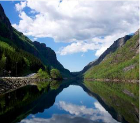
The lake Hovsvatnet lies in the central part of Lund, north of Moi. The lakes Grøsfjellvatnet and Teksevatnet lie on the western borders of Lund.Dalane belongs to the Sveconorvegian bedrock shield, and consists of two main geological formations of Proterozoic rocks formed during the Gothic and later Svekonorvegian mountain range ancestors, with strong metamorphosis under the latter.
A substrate of 1,600 - 1,450 million years old slate, quartzite, marble and amphibolite with some hornblende gneiss. The youngest Sveconorvegian formations are witnessed by larger formations of granite. In the municipality, 1,050 million-year-old granite and granitic eye gneiss dominate the upper structures. The Caledonian mountain range fold did not reach down here. The faults run both in the southwest-northeast direction and in the south-north direction.
The southwestern parts of the municipality belong to the 1,700 km² Rogaland anorthosite province, formerly known as the «Egersund field». This is a magmatite formation of deep rocks that also continues out into the North Sea in a similarly large area.
The most common rocks are the light solidification rocks anorthosite, the gabbro types norite and jotunite, further the economically interesting apatite, magnetite and ilmenite, as well as the deep rock mangerite. The apatite fields are rich in phosphorus and are felt on an extra lush vegetation.
2. 交通情况
The municipality's millennium site is Moi station. This is a restored building from the old Flekkefjord line which was completed in 1904. Moi station is a stately building which is now a stop and station building for the Sørlandsbanen line. The Norwegian Public Roads Administration has two webcams in Lund municipality.
三、经济发展和规模
Registration deadline 23 October 2020, The municipal director presents his proposal for the annual budget 2021 and financial plan 2021-2024 on Monday 26 October in the cinema hall in Lundetun. The presentation starts at 19.00 and is expected to end approx. 20.30. Attendance requires registration in advance.
Lund municipality consistently delivers good services to its inhabitants. Lund municipality is an active facilitator and good welfare provider. The municipal barometer for 2019 ranks the municipalities from best to worst based on approx. 150 different key figures. Lund municipality will for 2019 come out on 288th place out of a total of 421 municipalities.
The location for 2019 shows that Lund municipality has a potential for improvement, especially within child welfare, primary school, cost level, water / sewerage and finances. At the same time, it is important to point out that Lund municipality has good placements within daycare (40% best), nursing and care (25% best), culture (10% best), case processing (7% best) and social services (20% best) .
The measurement in the municipal barometer is complex and is not a direct indication of whether the municipality is run neither well nor badly. However, the measurement gives an indication of the level within the various areas.
Optimism characterizes the economic prospects for the region. Employment development is positive and unemployment is lower. Significant changes have been made in the region in recent years. Technological developments have contributed to many costly work processes being streamlined and carried out in a different way today. Lund municipality wants to be part of this development and on the basis of this has hired the municipality's very first digitalisation manager. It is important to follow developments at the same time as the level of digital / technological implementation is adapted to local conditions. This is necessary to create the services of the future.
四、产业特点重点项目
The preparation of a master plan for forest roads in all municipalities along the coast is anchored in the Coastal Forest Report from 2008. The report has been adopted by nine county municipalities from Rogaland to Finnmark and proposes a doubling of value creation in the forestry industry from the current level of approx. NOK 17 billion to about NOK 40 billion by 2020. In order to achieve the value creation goal, the development of a rational infrastructure and a good forest road network is required.
In Rogaland, the Coastal Forest Report has been followed up through the "Action Plan for Forestry in Rogaland" (2009) and the "Regional Plan for Agriculture" (2011).
Lack of forest roads is one of the biggest bottlenecks in exploiting forest resources along the coast. This also applies to Lund municipality, which has a significantly poorer forest road coverage compared with inland forestry - see figure below. In addition, we have climatic and natural conditions that place great demands on road coverage in order to run a rational and economical forestry. An overriding goal is to have as good road coverage as inland forestry in order to be able to realize the potential for value creation.
The preparation of a major infrastructure program for the coast is also a concrete measure that is part of the Coastal Forest Report. The master plan for forest roads is the basis for the infrastructure program.
The agricultural plan is a strategic business development plan that focuses on what can be a focus area for strengthening and further developing agriculture.
Local development strategies to further support and establish agriculture must be defined according to regional opportunities and challenges. The multifunctional role that agriculture has played in recent years - producing food, producing wood, focusing on the sustainable use of resources and not least helping to maintain settlement in the village - is only a small part of agriculture's contribution.
In this connection, the municipality has become increasingly important as a societal development actor.
The municipalities have a number of aids to be able to achieve the goal. The most important tool in this connection is the land management that is included in the municipality's land use plan, but also through the use of state transfers, e.g. in the form of SMIL (Special Environmental Measures in Agriculture) and NMSK (Business and Environmental Measures in Forestry) as well as the use of the municipal subsidy schemes.
The agricultural plan is a good tool for coordinating all these measures. It contains proposals for municipal agricultural policy and is thus only advisory and not legally binding.
Implementation of the planning work
The work with the agricultural plans for the years 2012-2016 was started in connection with the rolling of the municipal plan's area part in 2012. It was included in the planning program for rolling the municipal plan's area part that a new agricultural plan was to be prepared.
The agricultural plan is mainly based on the previously prepared plan, but is adapted in different areas. Among other things, the status part has been updated to the national and regional objectives and then the action part has been changed.
These objectives set the framework for the municipal agricultural administration and to a large extent for the municipal land management.
In a meeting on 29.03.2012, the Planning, Business and Environment Committee decided on members of the working group with the following composition: Svein Jarle Haukland (Labor Party), Marit Liland Øverland (Krf), the head of agriculture Britta Füser, Arve Hove from the forest owners 'association and Øyvind Steinnes from the farmers' association.
五、风景名胜,景点
1. Heskestad Church

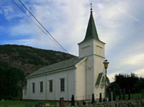
eskestad Church (Norwegian: Heskestad kirke) is a parish church of the Church of Norway in Lund Municipality in Rogaland county, Norway. It is located in the village of Heskestad. It is the church for the Heskestad parish which is part of the Dalane prosti (deanery) in the Diocese of Stavanger. The white, wooden church was built in a long church style in 1905 using designs by the architect Victor Nordan. The church seats about 240 people.
The earliest existing historical records of the church date back to the year 1380, but the church was not new that year. The medieval stave church was renovated during the first half of the 1600s. In 1734, the old church was torn down and replaced with a new building. In 1827, the church building was again torn down and replaced with a new building. In 1905, a new church was constructed about 700 meters (0.43 mi) north of the old church site. After the new church was completed, the old church was torn down.
2. Lund Church
Lund Church (Norwegian: Lund kirke) is a parish church of the Church of Norway in Lund Municipality in Rogaland county, Norway. It is located in the village of Moi. It is the church for the Lund parish which is part of the Dalane prosti (deanery) in the Diocese of Stavanger. The white, wooden church was built in a long church style in 1808 using designs by an unknown architect. The church seats about 420 people.
The earliest existing historical records of the church date back to the year 1409. The first church was likely a stave church. In 1618, the church was described as a small long church when records show that major roof repairs were carried out. Then in 1630, the nave of the church was renovated and enlarged. In 1808, the church was torn down and a new, larger church was constructed on the same site using many of the same materials that were salvaged from the old church. The new church was consecrated on 23 September 1812 by the Bishop Christian Sørenssen.
3. Fishing quotas

The fishing with us is varied as the nature in Dalane is. Here you can get big fish, lots of fish, easy-to-catch fish and fish that challenge you. We advise you to get in touch for help to make the trip successful. Dalane can offer a lot of exciting geology, peaceful spots, climbing trips and encounters with both animals and humans. We have many partners in tourism and experiences and would like a visit to us to give more flavor.
With us you can find peace by the trout water. There are good opportunities for canoeing in several of the watercourses. Please contact us for more information. The trout catches vary greatly in size and number depending on where you fish. Some waters have fine fish over a kilo, others are characterized by small fish.
https://www.inatur.no/fiske/50e57458e4b053634ccc837f/aurefiske-i-dalane
六、历史文化
1.历史
The parish of Lunde (later spelled Lund) was established as a municipality on 1 January 1838 (see formannskapsdistrikt law). During the 1960s, there were many municipal mergers across Norway due to the work of the Schei Committee. On 1 January 1965, most of the municipality of Heskestad (population: 547) was merged with Lund to form a much larger municipality of Lund.
The municipality (originally the parish) is named after the old Lund farm (Old Norse: Lundr), since the first Lund Church was built there. The name is identical with the word lundr which means "grove" (but here maybe 'sacred grove'). Before 1889, the name was written "Lunde".
The coat of arms was granted on 14 December 1984. The arms show three joined acorns in gold on a green background. The acorns symbolize the many oak trees in the municipality, as well as many toponyms and names of farms, which start with Eik (oak), such as Eik, Eike, and Eikeland.
Towards the end of the formation of the Sveconorvegian bedrock shield 932 million years ago, masses rose from the mantle up to a depth of up to 8 km. The older, Sveconorvegian gneiss and granite fields around the anorthosite formation were melted down and transformed under strong heat to, among other things, osumilite in a 15-30 kilometer wide zone.
Map of the geology of Dalane and Lista. Rogaland anorthosite province, formerly known as the Egersund field, is a 920-932 million year old formation of deep rocks, which originates from 1-8 km deep. It contains valuable minerals such as ilmenite and apatite.
The Egersund-Ogna anorthosite around Egersund consists mostly of anorthosite, and a little norite in the east. In the more eastern main bodies with the Helleren anorthosite and the Åna-Sira anorthosite, the relationship is reversed - light norite dominates over anorthosite. The two-part Bjerkreim-Sokndal intrusion in the northeast is the youngest, with layers of deep rocks from 1 - 7 km original depth, and deposits of jotunite, apatite, magnetite and ilmenite (FeTiO3) in both the northern Bjerkreim part and the southern Sokndal- the part. In the latter, Titania AS extracts ilmenite for the production of titanium (Ti). The mining operations in Rogaland anthropite province have roots dating back to the 18th century.The municipal coat of arms is three acorns that symbolize the three municipal parts Moi, Hovsherad and Ualand / Heskestad. The municipal coat of arms was designed by Svein Arild Berntsen in 1983.
2. 文化体育
There is no application deadline to become a student at Lund Cultural School. We admit students continuously as long as there are vacancies. All students who go to the cultural school will automatically get a place in the next school year, unless they cancel their place. Note, however, that all students / parents must complete a simple re-registration in SpeedAdmin every spring, where it is confirmed that the student will continue on the same subject, or want to change subjects / groups.
Lund municipality has a great swimming and activity hall. The facility has a 25 m swimming pool (28 ° C), its own therapy pool (35 ° C), its own swimming pool (38 ° C), squash courts and a fitness center with several activities.
Lund municipality can offer many beautiful nature experiences. From the exciting valleys and watercourses down in the lowlands and up to the high moors, there are countless hiking opportunities. Lund on tour gives you the chance to get to know better in some of the municipality's finest nature areas. If you collect more than 100 points (children 60), you can get this year's turn pin.
https://www.lund.kommune.no/lund-kulturskole.532786.no.html
七、其他信息
All municipalities in Norway, including Lund, are responsible for primary education (through 10th grade), outpatient health services, senior citizen services, unemployment and other social services, zoning, economic development, and municipal roads. The municipality is governed by a municipal council of elected representatives, which in turn elect a mayor. The municipality falls under the Dalane District Court and the Gulating Court of Appeal.
八、联系方式
Town manager: Magnhild Eia
Phone:918 85 196
Email:magnhilde@lund.kommune.no
Address:LUND MUNICIPALITY
Moiveien 9, 4460 Moi
https://www.lund.kommune.no/kontakt.515656.no.html
